Fig. 1 · the survey
The survey of the falls
Llewellyn Falls on Silver King Creek, measured on the USGS 1 m lidar flown in 2022; and what the lidar can and cannot see.
4.5 miles Below the falls
183 miles Silver King Creek → East Fork of the Carson → the Carson → Carson Sink The Great Basin · no outlet to the sea
The falls, drawn from the numbers
The same 400 m painted a second way, straight from the survey: every boulder, band and pine placed by distance and height, and the falls painted as a ledge, as Ryan & Nicola described it in 1976, about 20 ft, where the lidar sees a slope.

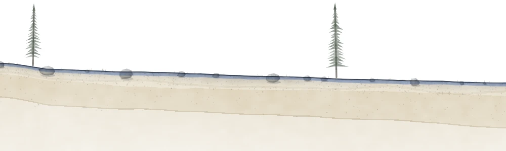
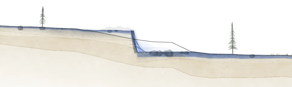
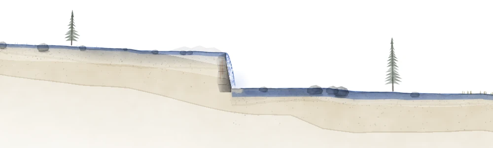
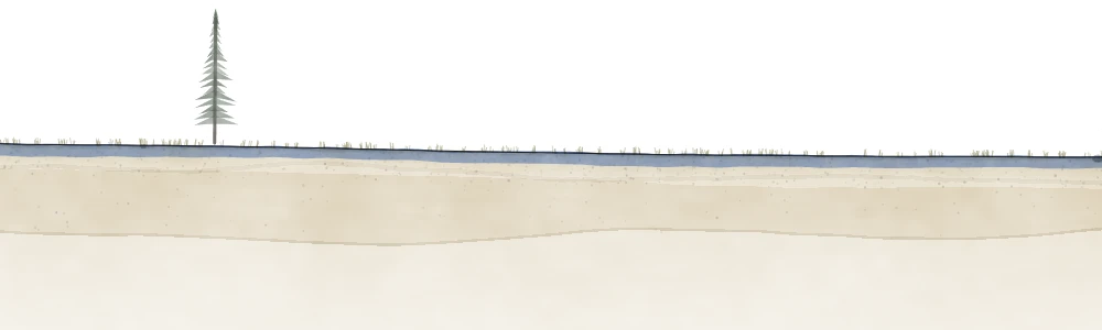
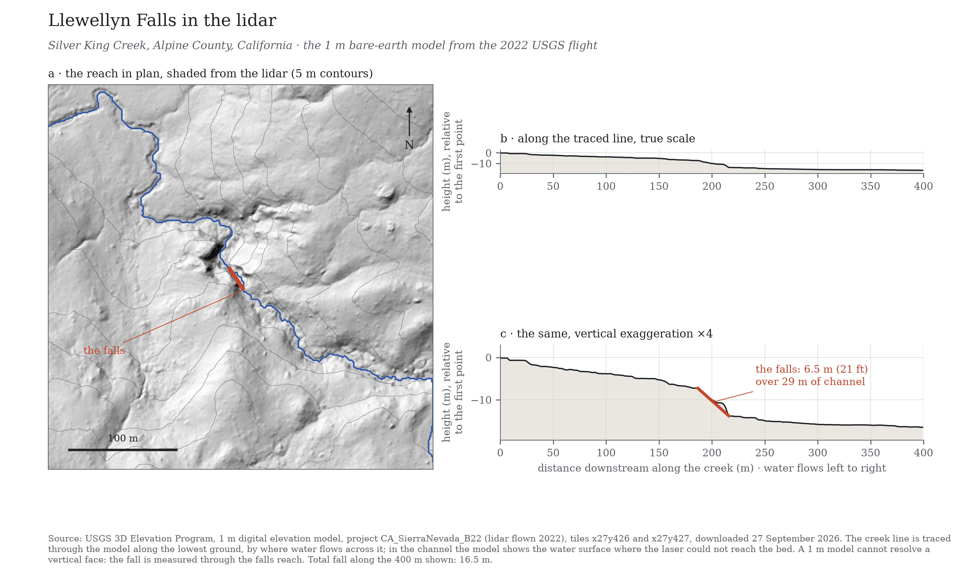
The lidar sheet
The numbers
| The falls, lidar | 6.5 m (21 ft) over 29 m of channel, 187–216 m along |
|---|---|
| The falls, on foot | about 20 ft (6.1 m), Ryan & Nicola, 1976 |
| The whole reach | the creek falls 16.5 m over the 400 m shown |
| The frame | 400 × 68.7 m at true scale: 1 m across is 1 m up |
| The source | USGS 3DEP 1 m bare-earth model, CA_SierraNevada_B22, flown 2022 |
How the line was drawn
The creek line is traced through the lidar model along the lowest ground, by where water would flow across it. In the channel the model shows the water surface where the laser could not reach the bed.
A 1 m model cannot resolve a vertical face. Through the falls it shows 6.5 m of fall over 29 m of channel: the drop and the sloping rock below it together, read in 1 m squares. That is the orange part of the line. It is the largest such step within 150 m of the falls as mapped.
The painting is a watercolor bent onto this line: its ground and its falls sit where the lidar puts them.
The height, every way it has been measured
| Source | How | Height |
|---|---|---|
| Walter Thornburg, 1933, quoted by J. O. Snyder, California Fish and Game 20(2), 1934, p. 111 | A written account quoted by Snyder: “some 20 feet of perpendicular drop. The water falls on a sloping apron of granite” | about 20 ft |
| Ryan & Nicola, California Department of Fish and Game, 1976 | “about 6.1 m (20 ft)”; how it was measured is not stated. Their Fig. 7 photograph (p. 17) shows a person at the pool | about 20 ft (6.1 m) |
| Ryan & Nicola, 1976, attributing it to Snyder, 1934 | A figure they correct: “about 6.1 m (20 ft), not 15 m (50 ft), as reported by Snyder (1934)” | No 50 ft appears in Snyder’s 1934 paper; its source has not been found |
| USGS 3DEP 1 m lidar, flown 2022, traced for this page | From the air, in 1 m squares; a face is averaged into a slope | 21 ft (6.5 m) over 29 m of channel |
| Our first survey, 23 September 2026 (withdrawn) | 21 points along a straight 400 m line, not the channel |
No one has published an instrument measurement of the face itself; the two figures of about 20 ft are estimates, and the lidar reads the whole step. The falls stands at about 7,980 ft above the sea (USGS 3DEP). Our first survey ran a straight line across the ground rather than down the channel; its 26 ft mixed hillside into the creek, and it was replaced by the lidar trace.
The falls in maps
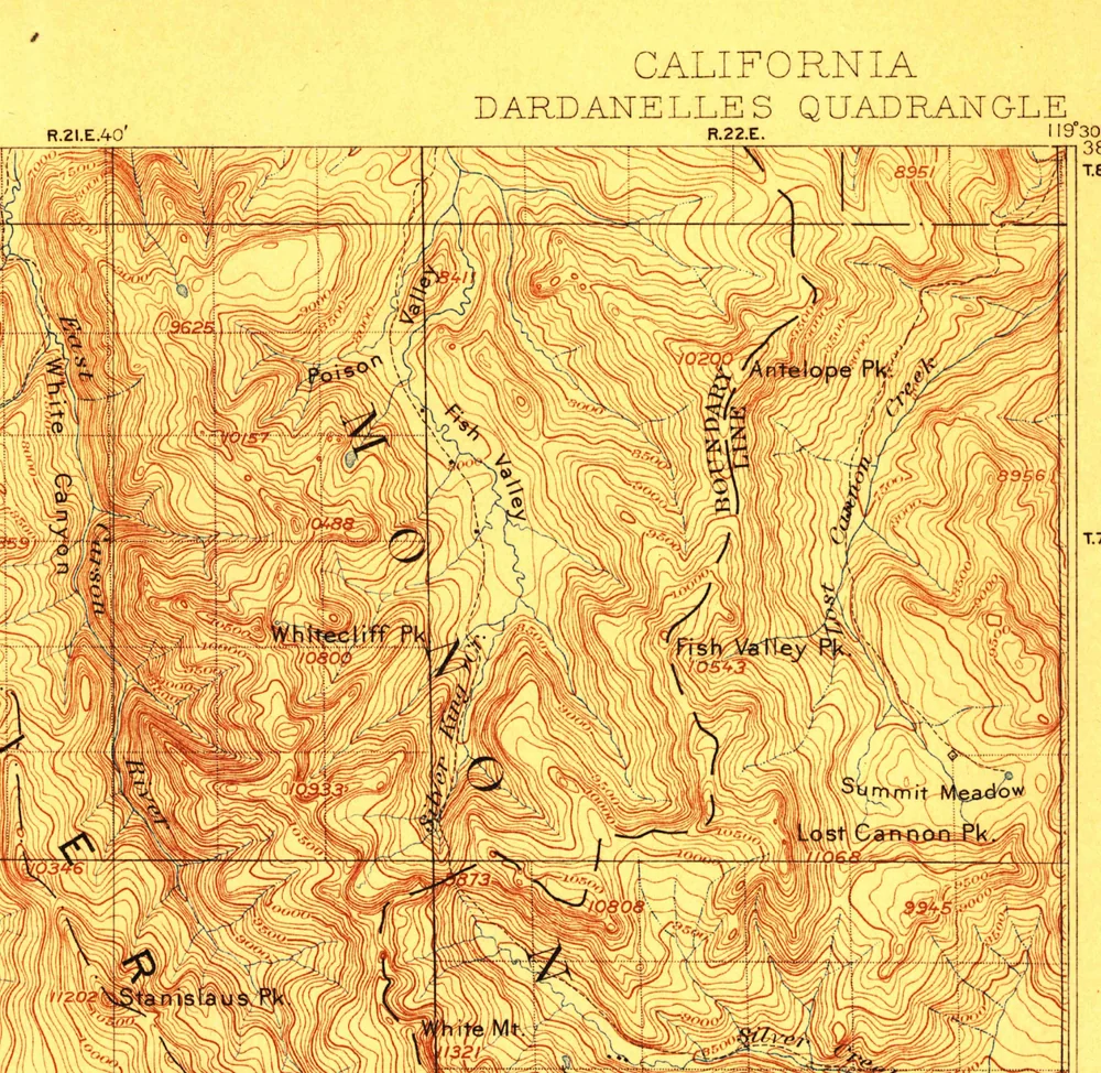
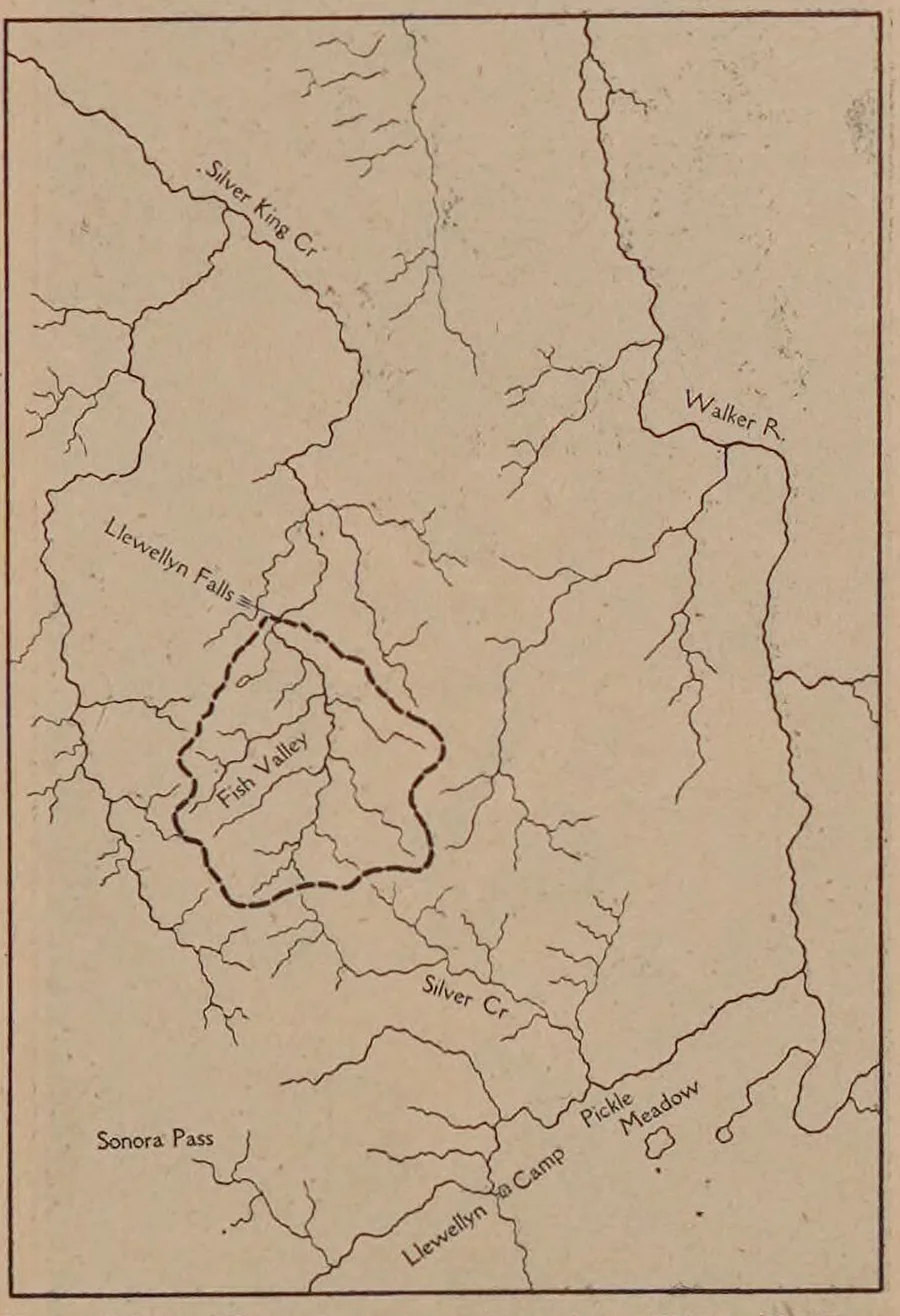
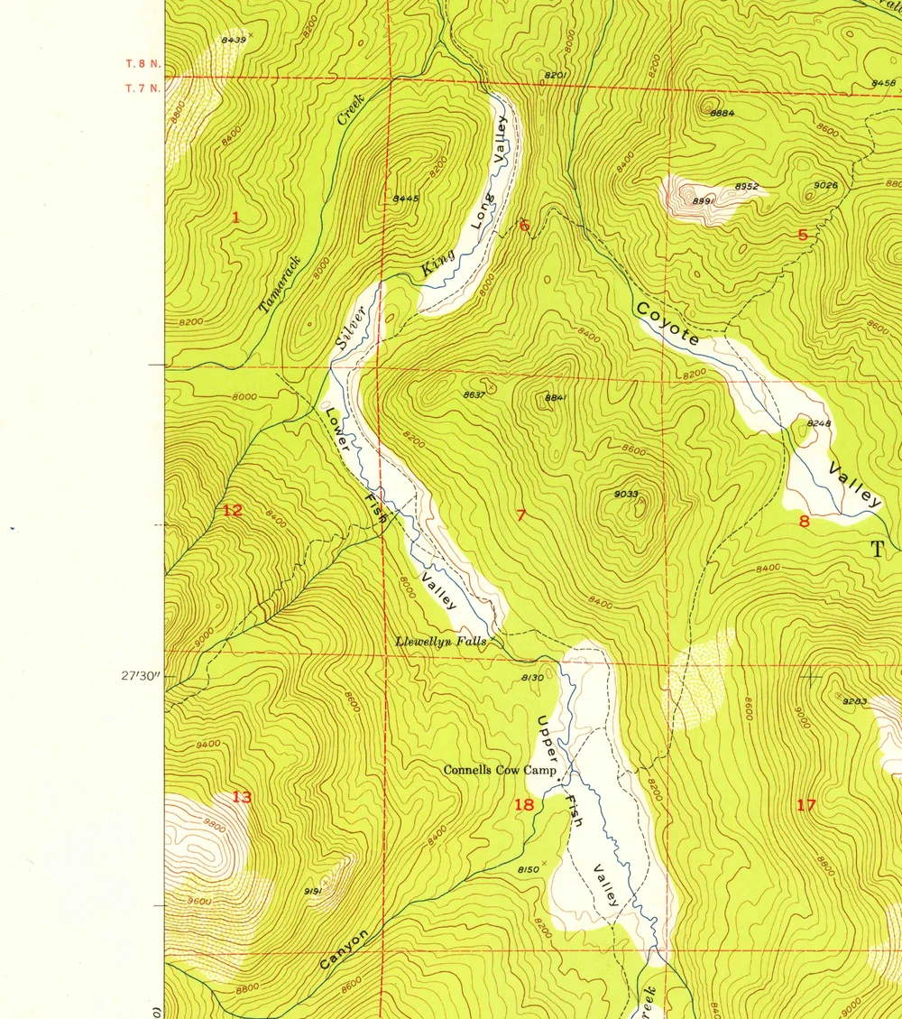
We have found no map before 1934 that draws or names the falls. The General Land Office plats of 1877 and 1879, the Wheeler Survey atlas sheet of 1883 and the USGS Dardanelles sheet, surveyed 1891–96 and reprinted into the 1950s, all cross the country and miss it. Snyder’s 1934 paper and its sketch map are the earliest documents we have found that write “Llewellyn Falls”; the first federal map to name it is the USGS Lost Cannon Peak quadrangle, from aerial photographs of 1953, field-checked in 1954 and printed in 1955.
Photographs
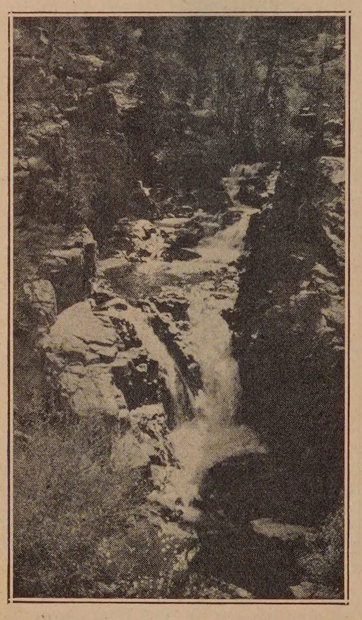
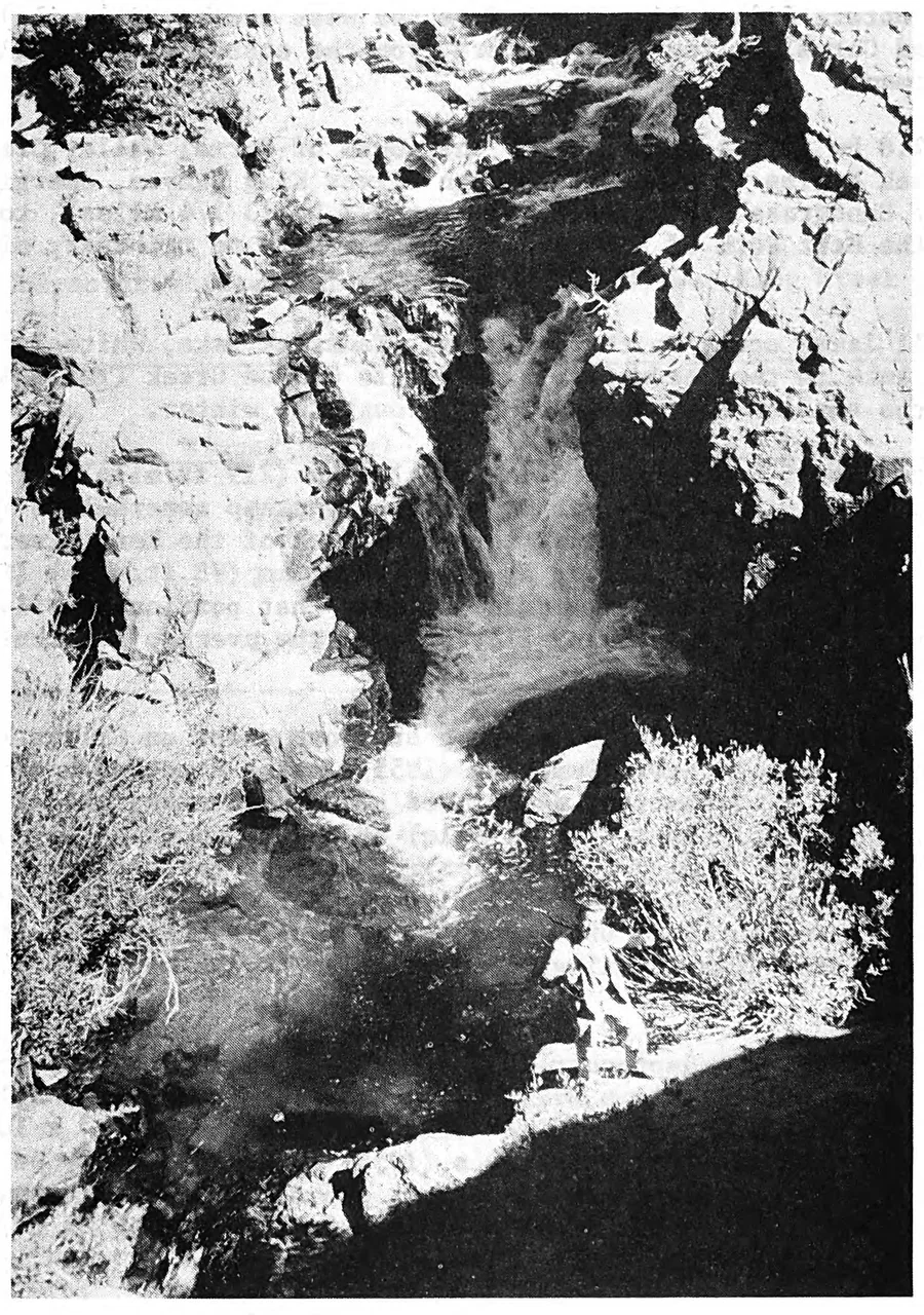
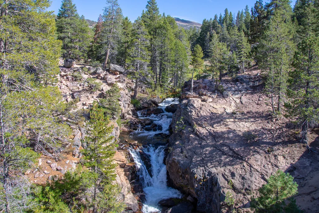
The name
J. O. Snyder’s paper of November 1933, in the Proceedings of the California Academy of Sciences, says in a footnote: “Specimens were collected by Mrs. Lynn Llewellyn and sent to the State Division of Fish and Game.” It does not name the falls. His 1934 paper and map are the earliest documents we have found that do. The federal place-name record carries no decision by the Board on Geographic Names.
That the falls is named for Mrs. Llewellyn is widely assumed and has never been shown; no document we have found says so before 1987.
The rock
The USGS geologic map of the Sonora Pass quadrangle (James R. Giusso, Open-File Report 81-1170, 1981, 1:62,500) prints the falls and maps the rock at and around it as the Stanislaus Group, Tertiary volcanic rock, with valley fill above and below. It maps nothing granitic there.
Walter Thornburg wrote in 1933 that “the falls are over granite rocks.” The map and the observer disagree. What rock forms the lip itself, a map cannot say.
The water
Silver King Creek runs into the East Fork of the Carson, the East Fork into the Carson, and the Carson, past Lahontan Reservoir, into the Carson Sink, in the Great Basin, with no outlet to the sea.
The land
The General Land Office patent index shows only two private patents in the falls’ township, to Charles Carney (1883) and Thomas J. Cochran (1888), both in its middle sections. It was Mono National Forest from 1908, administered from Gardnerville; in 1945 this country went to the Toiyabe, now the Humboldt-Toiyabe; since 1984 it has been the Carson-Iceberg Wilderness.
A pack trail up Silver King Creek through Fish Valley is drawn on the 1912 map; on the 1954 map the trail between Lower and Upper Fish Valley passes the falls. Sheep grazed the Silver King allotment from the early 1900s to about the 1930s, then cattle; the permit was cancelled in 1995. Connells Cow Camp, about a fifth of a mile upstream, is first named on the 1954 map, the earliest we have found to name it. A Forest Service heritage record, TY-3335, “Connell Cabin”, was evaluated in 1994; whether a cabin still stands there is unconfirmed.
Sources and data
- John Otterbein Snyder, “Description of Salmo seleniris, a new California trout”, Proceedings of the California Academy of Sciences, 4th ser., 20, 1933, pp. 471–472; and “A new California trout”, California Fish and Game 20(2), 1934, pp. 105–112.
- J. H. Ryan and S. J. Nicola, Status of the Paiute cutthroat trout, Salmo clarki seleniris Snyder, in California, California Department of Fish and Game, Inland Fisheries Administrative Report 76-3, 1976.
- U.S. Geological Survey: Dardanelles 30′ (1912 printing); Lost Cannon Peak 7.5′ (1954, printed 1955); 3D Elevation Program 1 m model, project CA_SierraNevada_B22, flown 2022.
- U.S. Fish and Wildlife Service, photograph by Joanna Gilkeson, 18 September 2019.
- General Land Office survey plats, 1877 and 1879; Wheeler Survey atlas sheet 56B, 1883.
- James R. Giusso, Preliminary geologic map of the Sonora Pass 15-minute quadrangle, California, USGS Open-File Report 81-1170, 1981.
- The profile every 5 m: distance and height relative to the upstream end (CSV).
- The creek traced at about 1 m: distance, UTM 11N easting and northing, ground height, upstream drainage area (CSV).
- The lidar sheet (PDF).